
30
days at sea
3
CTD casts
40,555
Km² mapped
PINGING IN THE NEW YEAR:MAPPING THE TASMAN AND CORAL SEAS

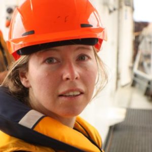
#CoralSeafloor
12/28/2020 – 01/26/2021
Brisbane, Australia
Chief Scientist: Dr. Robin Beaman
Co-Chief Scientist: Dr. Helen Bostock
James Cook University, University of Queensland, The University of Sydney, University of Wollongong, Geoscience Australia, CSIRO, Parks Australia, The Nippon Foundation-GEBCO Seabed 2030 Project, Birdlife Australia
Expedition objectives
Map, explore, and characterize new seamounts in the Coral and Tasman seas
Improve understanding of plateau and seamount geomorphology
Build and inventory of the number of seabirds, species present, and their observed behavior
R/V Falkor ended 2020 and began 2021 on a month-long investigation in the Tasman and Coral seas to conduct uninterrupted, broad-scale seafloor mapping, and to observe the concentration of seabirds in the area. Additionally, new protocols were tested for sampling marine microplastics in seawater. The mapping efforts concentrated on a large, previously unmapped survey area over the Chesterfield Plateau and along the chain of Tasmantid Seamounts within the northern Tasman Sea. A magnetometer was also towed during select, long transects to provide further insight into the geological formation of the northern Tasman Sea basin and the adjacent Chesterfield Plateau. At-sea seabird observation data were collected using standard protocols to establish baselines in the region. The goal of the seabird study was to better understand species distribution over space and time, which is often influenced by seafloor features and ocean productivity.
An improved understanding of plateau and seamount geomorphology relative to the basin’s tectonic setting resulted, which is important for understanding the evolution of the ocean basins.
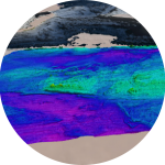
Extensive mapping revealed the detailed complexity of large, individual seamounts, such as the presence of underwater landslides and steep canyon features, and also revealed smaller, finer-scale volcanic features, such as parasitic cones. The new seafloor data enabled scientists to gain a better understanding of the spatial relationship between large-scale seafloor features in the Coral and Tasman seas. The data will also improve volcanic rock analysis, helping to explain the volume of magma produced at the time these seafloor features originated, which is crucial for better understanding the geological changes that have occurred on Earth. The finer-scale volcanic cones mapped around Cato Reef provide evidence for the extent of volcanic activity during the formation of the seamount.
The detailed multibeam bathymetry and backscatter maps were collected in an ecologically important part of Australia’s marine estate. Results from the expedition will help marine managers at Parks Australia identify areas of important conservation value and establish baseline knowledge of the area’s geology, geomorphology, and biodiversity. The data will help inform decisions on managing human influences in these deep ecosystems, such as commercial fishing activities.
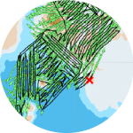
R/V Falkor collected the first multibeam data ping of the UN Decade of Ocean Science for Sustainable Development, which began on January 1, 2021.
R/V Falkor was the first ship to fly the Seabed 2030 initiative flag while collecting seafloor mapping data.
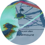
Mapping data revealed a complex seafloor – submarine landslides, gravity slumps, channels and broad valleys, sand waves, scour marks, volcanic pinnacles, and pock marks.
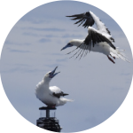
More than 15,000 seabirds were observed during the voyage from more than 20 different species.

